Pages

Showing posts with label Hurricane Irene. Show all posts

Thursday, August 25, 2011

How to Prepare for Hurricane Irene


Hurricane Irene is barreling toward the tri-state, expected to arrive in our area this weekend, and officials want everyone to be prepared.
There are three hurricane zones in New York City. Find if you live in one by going here. If you don't live in an evacuation zone but live in a high-rise building, you need to be prepared to take shelter on or below the 10th floor. High-rise buildings may space special risks during hurricanes, officials say.
If you live in New Jersey, plan your evacuation route here. For Nassau County, check here. For Suffolk, start here.
No matter where you live, officials say everyone should assemble an emergency supply kit (including a gallon of drinking water per person per day, nonperishable foods, a can opener, a first-aid kit, a flashlight, a battery-operation radio and extra batteries, a whistle, iodine tablets, personal hygiene items, a phone that does not rely on electricity, and child care supplies).
  • prepare a disaster plan (determine how to locate and communicate with family members, and make sure the home is properly insured);
  • know where to go (finding friends or family to stay with outside the evacuation zone, or report to a hurricane shelter);
  • keep a small "go bag" ready (which should include copies of important documents in a waterproof container; extra sets of keys; copies of credit and ATM cards; $50 to $100 in cash; up-to-date medication information and other essential personal items; first-aid kit; contact and meeting information for family members; child care supplies).

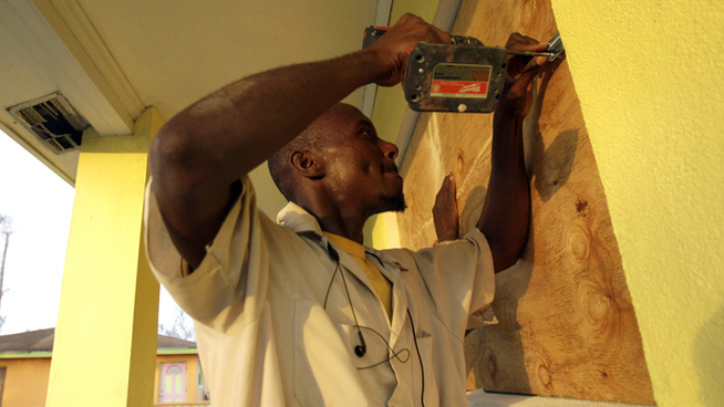
Homeowners should secure their properties. Storm shutters are the best type of protection, but if you don't have those, board up windows with marine plywood. Additional clips or straps are recommended to secure roofs.
Bring in loose, lightweight objects such as lawn furniture, potted plants, garbage cans, garden tools and toys. Anchor objects that would be unsafe outside, such as gas grills or propane tanks. Close up and secure patio umbrellas, and secure retractable awnings.
Remove aerial antennas and satellite television dishes.
Trees and shrubs around your home should also be well-trimmed. Also remember to clear your gutters.

New York state offers all-hazard alerts through NY-ALERT (sign up at nyalert.gov). The city offers the latest information on nyc.gov or at 311.

Residents should also monitor the National Hurricane Center to stay aware of current weather conditions. NBC New York's weather page is continuously updated here. The website will always stay updated and carry live streams from the newsroom and weather center in emergencies.
Get all the latest news and weather information by following us on Twitter @NBCNewYork and Facebook/NBCNewYork.
Posted Wednesday, Aug 24, 2011 - 5:07 PM EDT

Hurricane Irene path shifts west; may be worse for Long Island


The projected path of Hurricane Irene has shifted to the west, which could mean more severe weather for more of Long Island, the National Weather Service said early Thursday afternoon.
The new path would bring the center of the storm across Queens or western Nassau, said Ross Dickman, head of the Weather Service office at Upton.

Dickman cautioned that there is a 100-mile margin of error on the storm track, which means the center of the storm could miss Long Island entirely, but the Island would still see high winds and heavy rain in that case.

PHOTOS: Hurricane Irene on track for LI | Hurricane history
MORE: Map: Tracking Irene | Hurricane prep tips | More coverage

When it gets here Sunday afternoon or evening, Irene is projected to have weakened to anywhere from a tropical storm to a weak Category 2 hurricane, but is still likely to down trees and flood coastal areas, Dickman said.

It will arrive at a period of unusually high and low tides and will bring conditions similar to a very strong nor'easter. High northeast winds combined with the possibility of the storm hitting at high tide could mean trouble for low-lying areas along the North Shore, such as Asharoken and Bayville, and the shorelines of Peconic Bay in Orient and Montauk.

Dickman said the weather service expects about 6 inches of rain. The combination of soggy ground and high winds could bring down many trees and lead to extensive and prolonged power outages, especially on the North Shore, he said. Shoreline erosion and rip currents along the South Shore are also expected before the storm arrives. The weather service issued a rip current warning for Atlantic beaches Thursday.

A hurricane watch for Long Island could be posted Thursday night, Dickman said.
The National Hurricane Center said in an advisory at 5 a.m. that a hurricane-hunter aircraft found wind speeds of about 114 mph, making Irene a Category 3.

Officials believe the storm will regain intensity over the next 48 hours, then begin to weaken again. However, the Hurricane Center said the storm is so large, it will weaken slowly, and how it continues to develop will depend on whether it stays offshore or hooks over land."Since Irene has such a large and intense circulation, it will probably be rather slow to weaken," the Hurricane Center statement said. "Given the limitations in our ability to predict intensity change, there is significant uncertainty as to just how strong Irene will be when it nears the eastern and northeastern U.S. coast."

Irene's core was forecast to continue moving over the northwestern Bahamas on Thursday before heading north toward the U.S. coast, with its current path possibly bringing it to North Carolina's Outer Banks by Saturday afternoon, The Associated Press reported.
As of 8 a.m., the Category 3 hurricane was centered about 65 miles east-northeast of the Bahamian capital, Nassau, the AP said. Forecasters said the winds will ramp up quickly and Irene was expected to blow into a monstrous Category 4 with winds of at least 131 mph, the AP said.

Thursday was to be mostly cloudy with a high near 82, the weather service said. There is a chance of showers and thunderstorms, some with heavy rain, mainly after 3 p.m.
Friday will be mostly sunny with a high near 84. Saturday will be mostly cloudy with a high near 79. There's a chance of showers and thunderstorms, then showers likely and a thunderstorm possible after 3 p.m.

Shared from Newsday

Photo credit: AP | A man walks along the waterfront as Hurricane Irene passes to the east of Nassau on New Providence Island in the Bahamas. (Aug. 25, 2011)